Saturday, 1 August 2015

The Chair Of Idris

is a popular mountain in Snowdonia, south of the town of Dolgellau. Properly called Cadair Idris (often anglicised to 'Cader'), it rises 892 metres above sea level and, alongside Yr Wyddfa and Pen Y Fan, is one of the most clambered peaks in Wales.

But I've already done the other two, so on this occasion my Eldest and I will attempt to add this behemoth to our list of conquered summits.

We have opted to take the Minffordd path, which begins close to a car park and visitor centre/cafe just off the A487. The rest of our party have opted to remain at the base, so only two of us - armed with water bottles and enthusiasm - set off on the steep ascent, steps climbing up into a gorgeous waterfall valley. Eldest, as usual, has a keen eye for the flora and fauna surrounding us on this arboreal section of the journey.

Butterwort, a carniverous plant

Common Lizard, not camera shy.

Above the tree line, the vista opens before us. The journey will be a relentless uphill slog of about three miles. It will shorten our breath and abuse our feet, and every step we take will immerse us in the mountain and its legends.

Tongues of fire on Idris flaring,
News of foe-men near declaring,
To heroic deeds of daring,
Call you Harlech men.
                                   - 'Men Of Harlech'

Idris is a giant in Welsh mythology, but he seems to have been based on a real historical figure - Idris ap Gwyddno, a king of Meirionydd active in the late sixth and early seventh centuries. The summit of the mountain, Penygadair, the neighbouring 'saddle' and the adjacent peak of Tyrau Mawr are said to form his chair, hence the mountain's name. Boulders at the foot of the mountain are said to be stones shaken out of the giant's shoe, and any who spend the night on the peak will wake as either a poet or a madman.

It is also the hunting ground of Gwyn Ap Nudd, Lord of Annwn (the Celtic Underworld). The howling of his dogs, the Cwn Annwn, are said to foretell death to those who hear it.

Penygadair, the peak of Cadair Idris

To reach the peak we have to clamber up to the peak named Cwm Cau and walk round the ridge. At times the path is clearly defined; at other times, we find ourselves scrambling across rough scree and soft, boggy patches. After reaching Cwm Cau - which is an endurance test in itself - we descend into Bwlch Cau and look upward to the peak, only to find it no longer visible. The rippling ridges, a sea of scree, obscure the view. We have to keep clambering, hands and feet receiving a rough workout, and just keep heading upward. The views, in every direction, are breathtaking.


Below us lies the icy blue water of Llyn Cau. The crater in which it lays has given rise to the mistaken belief that Cadair Idris is an extinct volcano, whereas it is in fact glacial, carved by a cirque glacier during the most recent ice age.

Llyn Cau

Along our journey, we pass various geological features, rich veins of quartz creeping across igneous boulders.

Quartz veins

The descent from Cwm Cau into the saddle provides a brief respite, but before long we once again find ourselves ascending, feeling the challenge, scrambling across loose scree and round immoveable outcrops until, finally, the cairn on the summit is in sight and we can stagger gratefully to its base, glad to have knocked another mountain off our 'To Climb' list, which currently consists of Helvellyn and Ben Nevis.
The summit, 896m/2930ft, 'Penygadair'

Now the descent. We amble along the ridge until... it just kind of stops. Below us, a set of uneven steps disappear into the valley.

The steep valley.


Treacherous, slippery steps which vanish when they reach rock provide our route down from the ridge. Over a mile of them. We are actually quite grateful when we reach the treeline in one piece and descend into our waterfall valley.

Our companions, left behind at the Visitor Centre, inform us that we have been gone for four hours, which tells us that Cadair Idris took us an hour and a half longer to climb up and down than Pen Y Fan two years ago.

We drove away, heading towards our campsite in Shropshire, managing to miss a local monument which, at the time, we knew nothing about - the ruins of Mary Jones' Cottage. In the year 1800, the sixteen-year-old Mary walked barefoot from her home at the foot of the mountain to Lake Bala, twenty-eight miles away, to buy a Bible from the Reverend Thomas Charles. This feat inspired Charles to form the British and Foreign Bible Society, with its aim of supplying remote areas with Bibles. A memorial obelisk stands on the ruins of Mary's home, and a 'Mary Jones World' exists at Bala.

As we drive east, out of Snowdonia and into the Cambrians, the Chair Of Idris is gradually obscured by intervening peaks. We have walked in the realms of giants, of underworld hunts, and pious maidens with extreme fortitude, and emerged tired but intact.

Until the next lofty peak calls to us...


all pictures (c) Charlie McManus

Tuesday, 9 June 2015

The Mere

We arrive to a chaffinch serenade,
And park in the dust with entry paid.
The purple heath smoulders in the sun,
Where vipers slide and rabbits run.
The stonechat snickers, the slow-worm coils,
Beyond the haze, the North Sea roils.
The trees alive with fledgling tits,
Antlions strike from sandy pits.
Below the ridge, the Mere yawns wide,
Ringed by reeds where otters hide.
The bittern booms, the hobby swoops,
Black-head gulls form airy loops.
Harriers glide past squabbling geese,
Avocets nest in watchful peace,
Shovelers bob and terns dip low,
And red deer laze in the Summer glow.
Turtle dove calls from a lofty arbour,
Follow the shore to a sunken harbour.
Pipistrelles spiral in cerulean cool,
Swallows gather where the waters pool.
Charlie and Jin stroll with countenance glad,
Where celebrities gather for their Springtime fad.
Sticklebacks fan over hidden fry,
Under the camera's unblinking eye.
The ruined Abbey squats to our East,
A crumbling relic, a hulking beast.
We welcome Minsmere, forsake all strife,
To bask in joyful streams of life!


Friday, 27 March 2015

The Return Of The King

'Time has its revolutions; there must be a period and an end to all temporal things, finis rerum, an end of names and dignities and whatsoever is of this earth. Where is Bohun? Where is Mowbray? Where is Mortimer? Nay, which is more and most of all, where is Plantagenet? They are entombed in the urns and sepulchres of mortality.'
  - Sir Randolph Crewe

On 22nd August 1485, over 300 years of Plantagenet rule came to an end on a battlefield near Market Bosworth, Leicestershire, when a soldier in the army of Henry Tudor swung a halberd which fatally connected with the head of King Richard III of England, last of the Yorkist monarchs.

Bosworth, by James de Loutherbourg


Post-mortem,  Richard's body was subjected to certain indignities. He was stripped of his armour and thrown naked across the saddle of a horse, then accompanied by Tudor and his victorious retainers to the city of Leicester. After being exposed to public view for a couple of days - to demonstrate to the populace that he was definitely dead - the body of the last Plantagenet monarch was buried, without a coffin, in a hastily dug grave in the city's Greyfriars monastery. Richard's journey to Leicester lacked the pomp, pageantry and even the basic dignity that would normally be afforded a King of England on his way to his grave.

530 years later, Leicester took the opportunity to make it up to him.

Tricky Dicky.


I've wanted to visit Leicester for a long time, ever since I went through my 'Roman' period in the late 90's. I wanted to visit RATAE, the capital of the Corieltauvi tribe, wanted to see the baths complex known as the Jewry Wall.

Last Sunday I finally got to visit the Jewry Wall, but in a completely different context from that which I had originally envisaged. I came to Leicester on a bright and warm Sunday with my sons, not to specifically visit a Roman ruin, but to say goodbye to a King.

The Jewry Wall is bustling with visitors. The adjacent road and church mark the spot where the King will enter the City centre, and the old ruins are making the most of the carnival atmosphere. Morris men prance in the consolidated rubble. The great Roman remnant stands aloof, gazing down on the proceedings with haughty disdain.

St Nicholas Church and the Jewry Wall. With Morris dancers. According to legend, King Lear was buried under this spot, in a temple dedicated to Janus.


Leicester is buzzing today. 25,000 people have descended upon the City yet, strangely, it doesn't feel crowded. The roads are not at a standstill. Parking was a doddle. We left the car on the second level of a multi-storey behind John Lewis and strolled into the City Centre, instantly soaking up the carnival atmosphere of expectation. Everyone is smiling. Some are clad in medieval costume. Others clutch white roses, the symbol of the House of York.

Inside the ring-road from the Jewry Wall stands St Nicholas Square, one of Leicester's open spaces, and a large screen has been erected here, broadcasting the events as they unfold. The procession started hours ago, out in the Leicestershire countryside, and is winding its gradual way toward the City. In a couple of hours it will cross the Bow Bridge over the River Soar, and Richard Plantagenet will enter the City for the last time.

St Nicholas Square, and an air of expectation...


The story unfolding across the screen reminds us of the discovery, two and a half years ago, of a skeleton in a car park. They went looking for Richard, but few expected to actually find him. Richard Buckley, of the University's Archaeology Department, said he would 'eat my hat' if the King were actually found. He later ate a hat-shaped cake baked by a colleague. I remember seeing the bulletin on the evening news, the uncovering of a skelly on the Greyfriars site, a skelly with a crooked spine, and I remember staring gobsmacked at the TV and saying, 'F**k me! They've actually found him!"

Of course, it took several months of scientific analysis and DNA testing at the University of Leicester before they could call a press conference and confirm the skeleton's identity, but let's be honest - from the moment it was uncovered, it was never going to be anyone else.

We pick up a leaflet from a stall in the Square, and head off to explore the medieval street pattern of Leicester. We pass the Cathedral, TV crews already setting up in the grounds. We pace along New Street, stopping to glance briefly at the country's most famous car park, now off-limits. We explore the Lanes, a maze of winding streets and small, intimate shops. Youngest son splashes £8 on a crystal to wear around his neck. We call in on ASK, and treat ourselves to an Italian lunch.

Time is marching on, and we convey ourselves back across St Nicholas Square, taking up position on the roadside opposite the Jewry Wall. The crowds are dense, and the air is heavy with happy expectation. A stall to our rear sells tea and coffee in styrofoam cups. A dull, distant throbbing fills our ears as media helicopters buzz the sky above.

The horses arrive first, taking up position next to the church where the King will stop for a blessing. He will arrive in a hearse, but after the blessing he will be placed on a carriage and drawn through the streets of Leicester by four horses. The horses have been drafted in from the City Of London police, and are trained at dealing with events such as the Trooping Of The Colour. They are Lionheart, Ariel, Temple and Bowron.

Lionheart, Ariel, Temple and Bowron. (c)Charlie McManus


The air is heavy with anticipation, yet the crowds fall silent as the hearse appears. Only the rhythmic hum of the helicopters punctuates the quiet. The clergy of St Nicholas have lined up on the pavement to greet the monarch, and Richard's simple coffin is unloaded onto the shoulders of pallbearers and respectfully carried into the church.

While the brief ceremony is taking place, we make our move. Alongside many others, we decamp from our pitch and head into the city centre. Barriers line the High Street; we take up our second position near the Clock Tower in the heart of Leicester, my youngest son and I clambering onto a bench for an elevated view while my eldest son snakes his way to the barrier, camera at the ready.

Twenty minutes later, now decked out with the accoutrements of medieval pageantry, the King passes us again


(c)Charlie McManus


It was at this junction that one of the helicopters took the aerial photograph that would grace half of the next morning's newspapers, but I'm damned if I can make out my sons or myself in that crowd. Besides, we were probably on the move again at that point; while the cortege takes the long way round, we and many others hurry our way through the winding streets, past the stalls of Leicester Market, finding our way to the last street along the funeral route - a single lane road leading to the Cathedral. The crowds are thinner here and there are no barriers. Soon enough, the cortege comes swinging round the corner. People step into the road to cast white roses at the passing coffin; I fumble for my phone, switch to camera mode and click off a quick shot as the mortal remains of Richard Plantagenet pass by virtually under my nose.


We watch solemnly as the cortege disappears around the corner, heading for the Cathedral yard where it will be greeted by the Bishop Of Leicester and HRH Richard Duke of Gloucester, cousin of the Queen, who holds the same name and title that the late King held before he was enthroned.

My sons and I are buzzing. This will probably be the only chance in our lifetimes to give a medieval King a send-off, and we have risen to the challenge. As we make our way through the streets of Leicester, we feel a quiet sense of satisfaction that we have paid our respects to our most controversial monarch, and done our bit to give him the regal farewell denied him 530 years ago.

Richard's journey is over. The King In The Car Park can, finally, rest in peace.

'Shine out, fair sun, 'til I have bought a glass
That I may see my shadow as I pass!'
                                                         Shakespeare, Richard III

Thursday, 5 March 2015

On Going A Journey

The soul of a journey is liberty, perfect liberty, to think, feel, do just as one pleases. We go a journey chiefly to be free of all impediments and of all inconveniences; to leave ourselves behind, much more to get rid of others.  William Hazlitt, ''On Going A Journey',Table Talk, 1821.

Worcester

  The light was just dawning when I set out on my journey. Four hours later I'm standing in the nave of Worcester Cathedral, whispering into my mobile, asking my Eldest son to meet me so that I can drive him and his girlfriend home. They have been on a short holiday, riding a canal boat from Birmingham, but now their time is up and I have agreed to drive them back to Essex and home. So here I am, 9 45 in the morning, in a medieval colossus on the other side of England from where I live.


Worcester Cathedral, on the banks of the Severn

The Cathedral is a fascinating building, its life beginning as a Priory back in the Anglo-Saxon period. Nothing remains of that structure, but the present building was constructed between the eleventh and sixteenth centuries, and as such represents every style of architecture that was practiced during those years. I have only been here once before, back in 1998, and recall walking the banks of the Severn to the rear of the Cathedral. Along that bank is a tunnel, and upon the walls of that tunnel is a group of plaques representing the water levels of various floods. The Severn is notorious for bursting its banks and, indeed, it did so again a few weeks after that visit at the end of last century. I have had many occasions to use the Worcester bypass on my way to my Powys bolthole, and more than once have I witnessed the Severn floodplain turning into a colossal lake.

It won't take long for my son to reach me, so I make a quick tourist round of some of the Cathedral's internal features. The ashes of Stanley Baldwin are buried in the nave. He was Prime Minister three times, dominated national politics between the two World Wars and is the only Prime Minister to date who served under three monarchs - George V, Edward VIII and George VI. I linger at the chantry chapel of Arthur Tudor, who died at Ludlow Castle during his mid-teens, freeing his widow Catherine of Aragon to marry her brother-in-law Henry. I wander towards the tomb of King John, who requested burial here before dying of dysentery at Newark in 1216, only to be startled by the sight of a camera crew clustered around the chipped effigy. I wheel around and stride away, affecting a casual air, and that is how I inadvertently ended up in the background of a BBC documentary marking the 800th anniversary of the Magna Carta.

oops


Eldest son arrives, and we take a short walk to the boat moored on the Worcester & Birmingham Canal to pick up his girlfriend. One cup of coffee later, we set out on our drive across the country, back home to Essex. But, as usual when we are going a journey, we intend to make the most of it.

Tewkesbury

A few miles to the south, at the confluence of the Rivers Severn and Avon, lies another town famous for flooding. Its Abbey is the resting place of members of the Despenser family, Marcher Lords infamous in the reigns of the early Edwards, and George Duke of Clarence, brother to Edward IV and Richard III. He was executed for treason in 1478, supposedly choosing his own method of leaving the world by being drowned in a butt of Malmsey wine.

Tewkesbury Abbey


Battle of Tewkesbury, depicted in the Ghent MS


A glass coffin in the crypt supposedly contains the bones of George Duke of Clarence and his wife, Isabel Neville.


The town and its Abbey played an important role during the Wars Of The Roses, as a decisive battle was fought here. In 1471, flush from his recent victory at Barnet where he had defeated the powerful Earl Of Warwick, Edward IV of York engaged the Lancastrian forces headed by Margaret of Anjou, husband of the imprisoned Henry VI. The Yorkists won the day, several Lancastrian leaders sought sanctuary in the Abbey but were dragged out and beheaded, and the heir of Henry - Edward of Westminster - was murdered. Henry VI died shortly afterward, probably bashed on the head while praying in a chapel in the Tower of London. The Yorkists dominated the monarchy for the next fourteen years, until the two Houses were united by the marriage of Henry Tudor to Elizabeth of York.

After visiting the Abbey, we crossed the road and took lunch in a tea shop, a building dating back hundreds of years. Its walls were somewhat cluttered with photographs and other decor, but the cream teas were welcome enough.


Broadway Tower

After lunch, we drive northeast into the Vale of Evesham, reaching the A44 ( my favourite road) and climbing up to the scarp of the Cotswolds. Here, overlooking the Vale and a couple of miles shy of the village Bourton On The Hill, we stop to pay our respects to the best view in Worcestershire.


The Broadway Tower stands 65 feet high upon the second highest point in the Cotswolds. The Earl of Coventry had it built in 1798 as a folly, constructed by the architect James Wyatt to a design by the famed landscape gardener Lancelot 'Capability' Brown. The apparent reason for its construction is a typical example of British aristocratic idiosyncracy - seemingly, the Earl's wife wanted to see if her Cotswolds estates were visible from her home at Croome Court, now a National Trust property. The answer is 'yes'.

The Tower was acquired in 1827 by Sir Thomas Phillips, whose ambition was to own a copy of every book ever printed. Although he never fulfilled this ambition, he did use the Tower to house his printing press and 60,000 manuscripts. Later in the century, it was used as a retreat by artists, particularly those of the Pre-Raphaelite and Arts & Crafts movements. William Morris described it as "The most inconvenient and the most delightful place ever seen... how the clean aromatic wind blew the aches out of our tired bodies, and how good it all was." It inspired him to form the Society for the Protection of Ancient Buildings in 1877.

In the 20th century, thanks to its lofty position, Broadway Tower was a natural spot for the Royal Observer Corps to observe the movement of enemy planes, and indeed an enemy bomber crashed on the scarp in 1943, only a couple of hundred metres from the Tower, with the demise of all its crew despite the heroic rescue efforts of the tenant farmer. During the 'Cold War', when the fear of attack from the Soviet Union was paramount, an underground bunker was constructed 50 yards from the Tower, mostly for the purpose of monitoring nuclear fallout. It was mothballed in 1991, but remains fully equipped.

Ascending by spiral staircase the interior of the Tower, one finds each level a small museum, each devoted to aspects of the building's past; thus, you have a room dedicated to the Pre-Raphaelites, another to the second World War and another to the Bunker. Lastly, of course, the staircase opens out onto the crenellated roof, and the visitor is treated to one of the most astonishing and far-reaching views in Britain.


To the East, a view can be seen across the Cotswolds all the way to Buckinghamshire. To the North, the outskirts of the Birmingham conurbation and the rump of the Wenlock Edge hills in Shropshire. A Western view takes you across the Radnor Forest to the spine of the Cambrian mountains in Mid-Wales. Scanning toward the South will reveal the Black Mountains and, beyond, the cloud-shrouded Brecon Beacons. If you visit, make sure you visit on a very clear day!

To quote Hazlitt (again!): 'Distant objects please because, in the first place, they imply an idea of space and magnitude, and because, not being obtruded too close upon the eye, we clothe them with the indistinct and airy eyes of fancy. In looking at the misty mountain-tops that bound the horizon, the mind is as it were conscious of all the conceivable objects and interests that lie between; we imagine all sorts of adventures in the interim; strain our hopes and wishes to reach the air-drawn circle, or to 'descry new lands, rivers, and mountains', stretching far beyond it: our feelings carried out of themselves lose their grossness and their husk, are rarefied, expanded, melt into softness and brighten into beauty, turning to 'ethereal mould, sky-tinctured'. We drink the air before us, and borrow a more refined existence from objects that hover on the brink of nothing. Where the landscape fades from the dull sight, we fill the thin, viewless space with shapes of unknown good, and tinge the hazy prospect with hopes and wishes and more charming fears. 'Why Distant Objects Please', Table Talk, 1821. 

The Rollright Stones

We drive east, cleaving through the Cotswolds. We pass through oolite, pastel villages with eccentric names and charming topography. Bourton On The Hill meanders into Moreton In Marsh. We follow the serpentine route toward Chipping Norton, and take a small diversion to an ancient monument wealthy in local folklore.

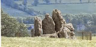
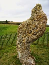
The prehistoric complex known as the Rollright Stones straddles a road that provides the border between Oxfordshire and Warwickshire. On the O side lie the King's Men and the Whispering Knights, on the W side stands the King Stone. They first arrive in recorded history during the 14th century, when they were mentioned by the anonymous author of De Mirabilibus Brittaniae (The Wonders of Britain):  "In the neighbourhood of Oxford there are great stones, arranged as it were in some connection by the hand of man. But at what time; or by what people; or for what memorial or significance, is unknown. Though the place is called by the inhabitants Rollendrith."


In fitting with the distinctive architecture of the Cotswolds, the monuments were constructed with the local limestone called oolite. Although forming a complex they were not created at the same time; the Whispering Knights came first, in the Neolithic as a type of burial chamber known as a Portal Dolmen. The stone circle known as the King's Men, and the single standing stone known as the king Stone, came in the early Bronze Age, when the Knights had already been standing for up to 2,000 years. It is usually a popular site, but on this day it was quiet and we mostly had the monuments to ourselves.

The names of the monuments have their roots in local folklore. The standing stone is an ancient King, the circle are his soldiers and the burial chamber is a group of treasonous knights, leaning into each other as they whisper in conspiracy.  This folklore was described by the antiquarian William Camden in 1610. Apparently an ambitious local King, with ideas of ruling the whole of England, was marching his army across Oxfordshire when he was accosted by a witch. The witch told him:

"Seven long strides thou shalt take, says she
And if Long Compton thou canst see,
King of England thou shalt be!"

The soldiers gathered in a circle to discuss the challenge, while the Knights clustered and plotted. The King puffed out his chest and took seven bold strides toward the village... only to find his view blocked by a mound of rising ground. The witch cackled:

"As Long Compton thou canst not see,
King of England thou shalt not be!
Rise up stick and stand still stone,
For King of England thou shalt be none;
Thou and thy men hoar stones shall be,
And I myself an elder tree!"

And so they were petrified, although no hint is given as to why the witch would turn herself into a tree. The tree is long gone, the vista-spoiling mound of earth likewise vanished, but the Rollright Stones and the village of Long Compton remain.

Apart from dinner at a pub in the Vale of Oxford and a stop to admire a view from the Chilterns, this is the last tourist spot to be visited this day. A simple mission to carry my Eldest and his girlfriend across the width of England became a major day-trip investigating points of interest in and around the Cotswolds, and another fascinating exploration into the beauty, history and legend of our remarkable heritage.

Roll on the next adventure. Right?

"I should on this account like well enough to spend the whole of my life in travelling abroad, if I could anywhere borrow another life to spend afterwards at home!"  Hazlitt


Wednesday, 4 February 2015

Corona And Morning Dew

A pale ring of ice hangs in the night sky,
Encircling a luminous Moon.
Spangled clouds the cumbrous satellite surround,
Silvered ghostlight permeates the ground,
Frost glistens to Luna's tune.

The same wan Moon bathes all the land
From Lowestoft to Cwmystwyth.
Perfidious miles no barrier to light,
Flagitious distance no obstacle to night,
From Arran down to Trottiscliffe.

It hangs over my town like the angelic crown,
Steadfast and effulgent.
The residents slumber in nocturnal peace,
A rime-kissed night, under clouds like fleece,
Their dreams of warmth indulgent.

Never far, but rarely near, by burnished hills you dwell
In your quiet moonstruck township; river, lake and Sunday bell.
Can you see the celestial orb, my lovely gamine friend?
O casual grace! Luna's embrace shrinks distance in the mind.
Linger in the firmament, wond'rous wilful you,
A warmth to calm my soul, a face as fresh as morning dew.

Ring of ice, your time will pass, with sunrise shall you fade.
Over into memory slip, the heavenly debt repaid.
Sol's dominion seize the day, with wintry blasts unwrapped,
Ever I'll know Corona's gaze, a favoured memory trapped!


Saturday, 8 November 2014

Samhain In Ytene

Ytene was, before the Norman Conquest, a large area of what is now Southern Hampshire. It means 'of the Jutes', and describes land colonised by the early Anglo-Saxon tribe of that name; the Jutes were also active in Kent and the Isle of Wight, their territories being split by the South Saxons modern Sussex).

In 1079, William I turned the area into a Royal Forest for his hunting interests, particularly of deer. Chroniclers of the time describe the destruction of hamlets and farmsteads, the native people dispossessed of their homes to allow the new aristocracy a place for their sport. Had the King been blessed with hindsight, he would have perhaps not been so eager - two of his sons, Prince Richard and King William II, died in hunting accidents in the Forest, in 1081 and 1100 respectively.

Domesday Book provides the first record of the area's name, 'Nova Foresta', and its English translation endures as the New Forest. Now a popular National Park, it occupies a large swathe of South-west Hampshire and extends its reach into Wiltshire and Dorset. It is famous for its roaming cattle, its ponies, and its deer.

It is where I decided to spend Halloween, accompanied by my Eldest and his girlfriend, eschewing trick-or-treat for the ambience of a sylvan Samhain.


Minstead

This attractive hamlet was our first point of interest, a little west of the Lyndhurst road as we headed south from the motorway. The village car park lies just across the road from the small, triangular village green. Facing it, we see a tea shop on its left, a bench under a small tree in its centre and a pub on its right. A group of New Forest Ponies graze on the green, and my companions are delighted to make the acquaintance of the renowned equines so early in our visit.

Ponies of the New Forest

Between the green and the pub, a short track climbs up to the village church. It is the oldest structure in the village, having a nave and chancel that date to the 13th Century, although its baptismal font is even older than the building - dating to the 12th Century. The churchyard contains weathered, lichen-encrusted gravestones around the building's entrance, and a large expanse behind the church which contains burials up to the present day. Among these, under a prominent tree, stands a stone carved in the shape of a cross, marking the resting place of the ground's most prominent resident: Sir Arthur Conan Doyle, here with his second wife Jean, under the epitaph 'STEEL TRUE, BLADE STRAIGHT'.

Grave of the Conan Doyles. Behind is the grave of the poet Christopher Tower, whose name is attached to a poetry competition in Oxford, and a reference library in Lyndhurst.


A tobacco pipe, representing the author's most famous creation Sherlock Holmes, is a constant fixture on the grave.

Back down to the village green, as we head back to the car we pass the pub The Trusty Servant, which has a most unusual sign.

At the sign of The Trusty Servant

The figure is known as a hircocervus in Latin, a tragelaph in Greek and, in plain old English, a goat-stag. It was mentioned by Aristotle and Plato, and it can be found on a wall-painting by John Hoskins at Winchester College, where its features represent virtues promoted by the students:

'A trusty servant's picture would you see,
This figure well survey, who'ever you be,
The porker's snout not nice in diet shows;
The padlock shut, no secret he'll disclose;
Patient, to angry lords the ass gives ear;
Swiftness on errand, the stag's feet declare;
Laden his left hand, apt to labour saith;
The coat his neatness; the open hand his faith;
Girt with his sword, his shield upon his arm,
Himself and master he'll protect from harm.'

Lyndhurst


As we drive south into the village of Lyndhurst, the heart of the Forest, we pass a pub called the White Rabbit. There is a reason for this.

Lyndhurst is, to be honest, a traffic nightmare. It lies on a crossroads, a crux of the cardinal compass points, and the presence of the New Forest Visitor Centre ensures its bustle. Despite the traffic it is a pleasant place with interesting shops and some architecturally attractive buildings. After a brief visit to the Centre, we stroll west, round the back of Lyndhurst Church. It was built in brick by the Gothic Revival architect William White from 1858 to 1867, and he later designed the church in Langdon Hills, Essex, where my daughter was christened.


To the rear of the church lies another grave with literary connections, which explains why a local pub is called White Rabbit. The ashes buried in this plot are those of a woman who, in her youthful years, inspired a family friend to create and publish stories that are now famous the world over.

Literature Meets Mortality

We pass around the front of the church, walk down to the road, and after a few steps we enter a cafe-restaurant where we have our lunch. The restaurant is called Mad Hatter's, and is adorned with Wonderland paraphernalia and illustrations.


Burley

Our next stop, deep in the Forest NW of Lyndhurst, and no better place to visit on Halloween. This popular village is famous for witches, thanks to a woman called Sybil Leek.


Sybil Leek (1917-1982) was once described by the BBC as 'Britain's most famous witch'. After the 1951 repeal of the 1735 Witchcraft Act, the many books she wrote on witchcraft and occult subjects played a major part in the revival of Wicca in the country. An antique dealer with an IQ of 164, she lived in Burley and was a familiar sight in the village, with the eccentric habit of walking around with her pet jackdaw (and, presumably, her familiar) perched on her shoulder. The jackdaw's name was Mr. Hotfoot Jackson. In her younger years Sibyl was an acquaintance of both Aleister Crowley and HG Wells.

Sybil Leek and Mr Hotfoot Jackson


Burley became a popular destination thanks to Sybil's high profile, but eventually she tired of the attention and emigrated to the USA in the early '60s. Her legacy remains, in the plethora of occult shops in the village, and the Halloween events that the village holds to this day. The village frequently demonstrates the ancient laws of the Forest that prioritise its animals - ponies and cattle freely wander its streets, and a herd of red deer can often be seen in the grounds of the Burley Manor Hotel.

The visit to Burley proved productive for all three of us. I came away with a new bottle of mead, my son with a mounted fallow deer antler and his girlfriend with some New Forest fudge. We also enjoyed dinner at the Queen's Head pub, served by staff members dressed as zombies and ghouls

The Queen's Head has a couple of points of historic interest. It was built in 1685 as a blacksmith's shop, and later when it became an inn it was known as a haunt of smugglers. During a renovation, a secret cellar was discovered, containing pistols, coins and alcohol - relics of the building's smuggling past. More recently, in 1963, a gentleman named Craven Walker found himself mesmerised by the curious shadows being emitted by a light in the bar, and it inspired him to invent the lava lamp!


Picket's Post

Dusk approaches, and with the last of the light we decide to enjoy an atmospheric stroll across the Forest. We choose Picket Post, an area of the Forest two miles out of Burley, just south of the A31.
Leaving the car in one of the area's plethora of car parks, we strike into the heathland. Gorse and heather proliferates, occasionally punctuated by gnarled and twisted trees, and a half moon rises into the clear Autumnal sky.

 In the half-light, ponies shuffle through the furze and Horseshoe bats whirl and dance around us. Tawny owls hoot from unseen arbours.. The ambience of Samhain infuses and enthuses us as we walk a ragged circle, an hour's journey across rutted and leaf-kissed ground, feeling the closeness and the intimacy of the Forest -  even in areas of open emptiness. Dark has fallen by the time we return to the car, the headlights of passing cars cutting through the lightly-misted atmosphere and giving us a dance of dazzling beams. My son sees the silhouette of a deer, skittishly dashing across the road, unseen by me as I was inspecting a milestone. Refreshed and revitalised by our bracing exploration, we prepare ourselves for the final event of the evening.


Wilverley Plain

On the A35, a few miles west of Lyndhurst and south of Burley, two laybys sit opposite each other. The road is unlit, and the layby looms suddenly; I have to brake sharply and swerve in order not to miss it. We vacate the car, leaving it with a cluster of vehicles already parked, and join a loose group of about two dozen complete strangers.

We head south, along a track that was once the Burley-Lymington road in the days of horse and carriage, some members of the group holding lanterns to softly illuminate our path. This part of the Forest is called Wilverley Plain, and after a few minutes of walking we step from the path to the site of what was once a tree called the Naked Man.


Surrounded by fern, capped with ivy, sits the stump of a vanished oak. Legend tells dark stories of smugglers and highwaymen hanged from its branches, one victim apparently struck by lightning which tore off his clothes - hence the tree's name. The truth, perhaps, is a little more prosaic - the tree probably had two outstretched arms which resembled a naked man.

Our group forms a circle of protection, and seasoned wiccans and druids take position at the cardinal compass points. Each of the four directions receives its own blessing.

The North is a place of cold, and the earth is silent and dark.
Spirits of the earth, we welcome you, knowing you will envelope us in death.

The East is a land of new beginnings, the place where breath begins.
Spirit of air, we call upon you, knowing you will be with us as we depart life.

The South is a land of sunlight and fire, and your flames guide us through the cycles of life.
Spirits of fire, we welcome you, knowing you will transform us in death.

The West is a place of underground rivers, and the sea is a never-ending, rolling tide.
Spirits of water, we welcome you, knowing you will carry us through the ebbs and flows of our life.

A loaf of bread and a horn of wine passes around the circle, each of us tasting and imbibing before passing on to our clockwise neighbour.  It takes almost three circuits before the offerings are gone.

The Wheel of the Year turns once more, and we cycle into darkness.

Two members of the group, using a wooden phallus and a chalice, re-enact the marriage between the Morrigan and the Great Dagda, pouring the contents of the chalice onto the soil to represent the hope of rebirth after the coming Winter.

At the end of that darkness comes light. And when it arrives, we will celebrate once more.

We remember those we have lost, we bless those who need succour, and we close the Circle in harmony. The four elements suffuse us. The breath of the breeze, the dewy dampness of the grass, the mud beneath our feet, the muffled thud of distant fireworks from the direction of Christchurch. In an intimate cluster on the dark open mass of Wilverley Plain, the traditions of the Old Craft continue. Behind us as we depart, the Forest lives, breathes and watches... as it has done for close to a thousand years, as it will for a thousand more. The wheel turns, the cycle continues. As above, so below.

So must it be.


I see across the veil to the pathways of my future
The pathways laid out for me by my ancestors, who walk
Them with my gods.
These pathways I will walk in company with them,
When I have finished my work here, until that time
I will live my life with honour and courage
With them forever in my mind.

Wednesday, 30 July 2014

And The White Horse Looked On


Before the gods that made the gods
Had seen their sunrise pass,
The White Horse of the White Horse Vale
Was cut out of the grass.


...about three thousand years ago, according to radiocarbon dating, making it the oldest known hillfigure in the country. Its abstract, curving lines are typical of Celtic artwork, and it may be associated with the tribe that used the Uffington Castle hillfort close by. It rests high on the scarp, not easily seen in its entirety unless from the air or from the railway line that snakes through the Vale on its way to the West. It is the most famous of our chalky White Horses.

Assuming, of course, that it is a horse.

And here we are again, in this familiar place, Team Vulpine today consisting of my sons, daughter, and daughter's boyfriend - the latter on his first visit to the site. I seem to make my way to this hallowed spot every couple of years, and wandering this landscape of shadow and legend, it always feels like that first time two decades ago.

Polite National Trust signage asks visitors not to stand on the Horse, to lessen the dangers of erosion. On our bellies we writhe like earthworms, shuffling abdominally toward the stark ivory outline, reaching forth tentatively to touch an ear, caress a curve, lay featherlight fingers upon the tip of an ancient tail. Its single eye gazes impassively across the broad Vale, taking in the expanse of Oxfordshire, the Chilterns smouldering in the haze to the East, the Cotswolds rising on the Northern horizon, the doomed cooling towers of Didcot scarring part of the view like a pustule on the landscape. In a few weeks they will be gone, brought down in a flash of explosive, a rising cloud of dust and a rumble of destruction, and the Horse will once more keep watch over Arcadian purity.

(c) Emily McManus


Before the gods that made the gods
Had drunk at dawn their fill,
The White Horse of the White Horse Vale
Was hoary on the hill.


Bees and butterflies whirl above the figure, crows and kites ride the thermals. Below the Horse, in the sheep-speckled undulating slopes known as The Manger, a small hill sits squatly, looking like a miniature Silbury. Its crown gleams white, the feet of thousands having scoured it down to the chalk. This is Dragon Hill, according to local legend the spot where St George slew his serpentine foe. Unlikely, I muse, that our patron saint walked these hills. Or killed a flying, pyromaniacal, maiden-devouring dinosaur. Or existed. It is, however, fuel for the posited notion that the Horse, equine lines obscured by its abstraction, is actually a dragon.

Dragon Hill

On previous visits we have clambered down the slope to stand upon the Dragon Hill, but that is not the route we desire this afternoon. Above the Horse lies the hillfort Uffington Castle, a pre-Roman stronghold with an impressive ditch and rampart, and we will venture into its interior on our way to the timeworn trackway that crosses the peak of the Downs, the popular footpath known as the Ridgeway, linking the hills beyond Dunstable to the great stone circles of Avebury.

In the grass of the great enclosure that predates Jesus, is a curious attempt at Christianisation; someone has poured a cruciform shape onto a patch of short verdure, a cross formed of cremated remains. Someone must have loved this place a great deal to have their ashes deposited here. The shape will likely not last, blown by the winds of the high Downs and disturbed by the bumbling passage of sheep and tourists, and all that will remain is a human spirit, adding to the ghosts that haunt and protect the Horse.

We have arrived in the late afternoon and most visitors are wandering away from the site. The Ridgeway is quiet and warm, a dusty route along which we strike west.


Age beyond age on British land,
Aeons on aeons gone,
Was peace and war in western hills,
And the White Horse looked on.


Fields of ripening wheat surround us, the sun illuminates and heats our old green track, an owl twits unseen from a canopy of tall trees. If we walk and walk, we will pass the great Iron Age enclosure of Liddington Castle* and strike south to the mighty prehistoric landscape around Avebury... but we have no intention of going so far. Our destination, after a slog of about twenty-five minutes, is another monument of legend. It lies, slumbering in a glade, to the right of the track.


Wayland's Smithy Long Barrow is a Neolithic burial chamber of the group known as 'Cotswold-Severn', which also includes such popular sites such as West Kennet in Wiltshire and Belas Knap in Gloucestershire. They are trapezoidal in shape and represent a fairly localised form of prehistoric funerary architecture. Like its colossal sibling at West Kennet, the Smithy has chambers which have been vacated by their long-skeletal inhabitants and are now accessible to all. It is at its best on a Summer day such as this, the June trees bathing it in dappled light, abandoned by the public and, at this moment, belonging entirely to us. Its atmosphere, thoughtful and peceful, is amost tangible. Such stuff as legends are built on, and the legend of Wayland's Smithy is a doozy.

Youngest son explores a monument

Previous visitors have left votice offerings on the baked stones that protect the cool chambers, offerings of copper pennies. They too, know the legend of Wayland the Smith. He was an Anglo-Norse deity, and it was probably those settlers back in the Dark Ages that gave the monument its enduring name. The legend tells that a horse, if deposited at the Smithy with a small coin as payment (probably a groat, although clearly modern visitors have taken inflation into account), the horse would be mysteriously shod by the unseen god. Some of our great writers have included this legend in their works, Sir Walter Scott in Kenilworth and Rudyard Kipling in Puck Of Pook's Hill

.

The sun continues its descent, and we undertake the return stroll to White Horse Hill. The unseen owl continues to whistle down from the trees that line the track. Insects hum and bustle in the Summer breeze that accompanies us. A concealed pheasant barks out its raspy cough from a neighbouring field.

"There," my daughter helpfully gestures towards a shape trying to hide itself in the stubble. I gaze appraisingly at the prospective fowl.

"Hmm," I muse, "Looks more like a hare to me."

As the words leave my lips, the magnificent creature springs to life, tearing across the field away from us and as we stare admiringly at its sprinting form we finally notice the others, scattered across the field, at least half a dozen hares browsing the stubble. My daughter's boyfriend stares entranced; this is the first time he has seen one of these superb animals.

(c)Emily McManus


Our walk ends back at the car, and off we go. Leaving a land of legend and natural beauty behind us, we drive down into the Vale and strike east. Our tents await us near Watlington, England's smallest town, where we have camped below the Chilterns and in the shadow of another hillfigure, the pyramidal Watlington White Mark. We will sleep below the wheeling red kites and the starry Oxfordshire skies, and the sun will bid adieu as shadows fall across the Vale. And the White Horse, as always, will look on.

 For the White Horse knew England
When there was none to know;
He saw the first oar break or bend,
He saw heaven fall and the world end,
O God, how long ago.
                                  GK Chesterton, Ballad Of The White Horse (1911)

* Liddington Castle was discussed in more detail in my previous article, In The Footsteps Of Arthur: Badon Hill