Thursday, 17 December 2015

Forts And Foreshores: The Return


One of the most pervasive memories of my recent visit to the saltmarshes east of Gravesend was that haunting sense of solitude, that aching feeling of loneliness when an explorer realises that he is an aberrant human speck in a landscape of quiet stillness. I walked out there looking for an abandoned Victorian fortress, only - to my pleasant surprise - to find a completely different Victorian fortress, as well as an unexpected shipwreck.

For my return visit, undertaken with a determination to fulfil my original mandate, I took along my daughter who, in recent months, has become something of a veteran at Urban Exploration. Although this particular quest is anything but urban, the fact that crumbling relics of centuries past are the payoff is right up her street.

We park slightly east of the village of Higham, and set off along a footpath heading toward Gravesend. To our right, a scrappy hedgerow separates us from the marshes and, on our left, an abandoned section of the old Thames and Medway Canal, neglected and choked by reeds, follows our route. Presumably this track is part of its old towpath. Despite its dilapidated condition, there is local interest in restoring this
historic waterway.

Thames And Medway Canal Map. Gravesend at the top, Rochester at the bottom, Thames on the right

Presently, we hook a right onto the marshes, following an old military track, passing signs which warn of a nearby firing range - the Milton Range, used by the Metropolitan Police to train their marksmen. This track carves a straight line north, stopping short of the foreshore as it reaches the structure that we have come to visit. The Shornemead Fort.


Two views of the Shornemead casements from the rear, showing the ravages of time and taggers.


This is actually the third structure on the site. A polygonal battery was set up in the late 18th century, at the height of the Napoleonic Wars. This was supplanted in the 1840's by a larger polygon with barracks. As with many heavy structures along this stretch of foreshore, it suffered serious problems with subsidence. Finally, in the 1860's, it was decided to rebuild Shornemead, Coalhouse Fort on the other side of the river and construct the new Cliffe Fort to the east, providing a deadly triangulation of artillery to protect this stretch of the Thames. They were all designed by Captain Siborne of the Royal Engineers, and Shornemead came in at a cost of £211, 063.

View of the eastern Casements, from the foreshore


The fort remained active until the 1950's, although its purpose changed with the times; it was disarmed of its heavy guns at the turn of the 20th Century, due to its on going subsidence problems. For a time, it was used by the Thames Militia Division (Submarine Miners), Royal Engineers as a training centre before being recommissioned with artillery during the First World War. The Second World War saw it being replenished with a battery, pillboxes, searchlights and other structures, traces of which can still be located; the whole area was surrounded by a tangle of barbed wire.


Western casements from the foreshore. Younger vulpine there for scale.


Once peace returned, the Fort became obsolete. Barracks and administration buildings were demolished, although the Casements and the underground magazines survive. However, only the overground remnants are officially accessible.

Shornemead Fort is not as inaccessible as it's neighbour at Cliffe (as demonstrated by the fact that there were other visitors, two teenagers on bicycles), and there are fewer remains to be seen... yet it remains evocative. A stroll around the inside of the Casements reveals hooks and winch machinery still in situ, the rusting remnants of the equipment once used to drag heavy ammunition from the magazine's to the surface. Such equipment can still be seen in good condition under the ramparts of Tilbury Fort, a couple of miles away on the northern bank of the river.

Small rectangular holes in the ground, half-heartedly concealed by rubble masonry, reveal the continued existence of the subterranean tunnels, but ingress is hazardous due to their flooded and decaying condition. However, in the recent past, adventurous souls have succeeded.
Shornemead in relation to Coalhouse and Cliffe Forts


This part of our exploration over, we returned to the car and headed east, driving through Higham and toward Cliffe, passing the impressive gatehouse of Cooling Castle as we did so. This site, once owned by the gentrified Cobham family and abandoned after being severely damaged during the Wyatt Rebellion of 1554, is now a rather agricultural-themed venue that hosts wedding receptions. A villa in the grounds beyond the Gatehouse is the home of a well-known musician.

Cooling Castle


We keep as close to the shore as we can, reaching our next point of interest at a sharp bend in the road just before it reaches the village of Cliffe. The ground is higher here, overlooking the marshes and a hook in the river, and we can see below us a complex of flooded quarries - now an RSPB reserve - and, between the reserve and the foreshore beyond, our next destination... a sprawling complex of scattered buildings, abandoned and forlorn, yet braving the hostile saltmarsh elements as they have since they fell out of use close to a century ago. Occupying an area a mile long and a kilometre wide: the Cliffe Explosive Works.

Cliffe Explosive Works, aerial view, ©NMR


Satellite view of the Cliffe Explosive Works


The factory began as a small works, set up in 1892, by a Scottish company named Hay, Merrick and Co. It was acquired six years later by the Hounslow-based Curtis and Harvey, who vastly expanded the original factory to the size it remains today. It manufactured and stored nitroglycerine, cordite, gelatin explosives and a chlorate-based explosive called Cheddite.

The buildings were spaced far apart to minimise the risk of accidental explosions causing chain reactions; nevertheless, in the twenty-nine years that the Works was operational, sixteen people lost their lives. The worst year was 1904; two explosions, a fortnight apart, killed six workers. It was a dangerous line of work, despite the best precautions of the time.

Cliffe Explosive Works. On the other side of the river, Coryton and Canvey Island in Essex. ©Friedman of KHF


The sharp downturn in the explosives market led to the Cliffe site closing in 1921. Some light demolition took place after the closure, but these buildings - for obvious reasons - were built very sturdy indeed, and as it was simply too troublesome to level them completely, they were simply abandoned to the elements. And here they remain, in a remote pocket of the Hoo Peninsula, steadfastly resisting the ravages of the last ninety-four years. The main threat in recent years came from the suggestion of an airport being built on the marshes, an idea put forward by a floppy-haired London Mayor with a clearly less than cursory knowledge of civil engineering. Unsurprisingly, the idea never got off the ground ( pun intended).

We walked a rather circuitous route to get to the Works, as we had to skirt the flooded quarries of the Nature Reserve. Upon arriving, I observed that the site was as bleak and austere as the other saltmarsh sites, although the presence of many ditches and channels made it somewhat more treacherous. We were not alone, however; there were plenty of cows and sheep wandering the ruins, and a handful of corvids and marsh birds, including a heron.

The site is owned by the Port Of London Authority and managed by tenant farmers, and permission to enter is never given. We decided to ignore the whole 'permission' thing, and just be discreet. Around the breezy and somewhat forbidding site we roamed, trying to make sense of some very alien structures.

Apparently a cordite store


Ninety-four years of abandonment but, unlike the forts at Cliffe and Shornemead, hardly any graffiti. We found some cattle bones scattered over a large area, evidence of the site's isolation from civilisation. If a cow drops here, then it stays here.

Abandoned buildings, purpose unknown


Nope, no idea.
.


Inside one of the buildings, we found a curiosity. A caravan, which showed evidence of brief occupation in 2008. It would have quite a task to drag a caravan across such hostile terrain and then jostle it into a corner of an abandoned shed, and the motive for such an action remains a mystery.

?

Our mission is complete. We have traipsed the North Kent marshland and visited our two isolated sites. We have not worn holes in our shoes, but it certainly feels as though we have worn holes in our feet. Exposure to the autumnal elements has led us to feel tired, hungry and, not surprisingly in such a saline atmosphere, thirsty.

An hour later, with the descent of night, we find ourselves nestled in a snug corner of a pub at the western end of Rochester's charming Dickensian High Street, eagerly awaiting the meals we have ordered, and taking deep draughts of the drinks we have earned. Like Edwin Drood, the relics of the Hoo Peninsula may be mysterious, but they are no longer remote from our experience.


Links:
Shornemead Fort in the 1920's
Cliffe Explosive Works, inc. Inquesr Report on 1904 Explosions
Forts And Foreshores (Part One)
Forts And Foreshores: The Other Side

Sunday, 1 November 2015

Samhain In Southwark

Here the veil between the worlds dissolves:
the living, the dead
share the brew, break the bread.
Ancestor souls
converse and commune this Samhain night,
by the light of a bone-white moon. 
  - The Southwark Mysteries


The Prelude

Three people stroll along a footpath that crosses a sunny Suffolk heath. Spring 2015, and the large tracts of heather through which the path carves are alive with rabbits, adders, stonechats and fledgling tits. Insects toil and spin in the busy air; in the near distance, the constant washing rumble of the North Sea provides a gentle background melody.

We notice the anomaly at about the same time. Just off the path, in a space between outcrops of heather, lays a patch of disturbed ground, a small bump, as though someone has lifted the turf, placed an object beneath, and not bothered too much about concealment when replacing the strip of earth.

My eldest and his girlfriend watch with expectation as I step from the path, crouch by the anomaly, and lift the turf. Below lies a small Tupperware box, and I deduce what I have found from previous experience. "It's a geocache."

These are small containers, thousands of which are concealed around the countryside and towns of the UK. They are usually located using GPS devices and reference to certain websites which provide cryptic clues to their location. We've sought out a few in the past, at Rye, on the North Downs, and around Saffron Walden; but this is the first time we have found one accidentally.

I peel off the lid and we inspect the contents. Normally they contain a small notebook or strip of paper accompanied by a pencil, so that the finder can record their name(s) and the date of the discovery. There are also small inconsequential objects, such as beads, paperclips or small denomination coins; the idea is to take an object from the cache and replace it with another.

I drop a coin into the box and lift out a stone which I inspect with interest. A small piece of brown flint, almost lozenge shaped, pitted and scarred, pierced by natural forces with a hole. Almost a miniature of the Men-An-Tol, that curious Bronze Age monument down in the deep west of Cornwall.

Now it's mine. I slip it into my pocket, this tiny tolmen, this igneous token. A pierced pebble, symbol of age and endurance, resonant of the Sacred Feminine, plucked from the humming, breeze-caressed surface of Dunwich Heath, where 'the vipers slide' and 'the slow-worm coils'.

It is with me still.


The History

31st October 2015.

Along a South London backstreet, minutes from the pungent bustle of the Borough Market, I pause and gaze at a large set of iron gates... or, rather, the decor that covers almost every inch of them. Ribbons, cards, photographs, messages;dense and defiant, as though to conceal what rests beyond this barrier. High on the gate, a circular plaque tells the story.


According to parish records, the burial ground now known as Crossbones was acquired by the parish of St Saviour in 1769 as a cemetery for the poor; however, many believe that it was in use before this date, possibly being the location of the 'Single Woman's Graveyard' mentioned by John Stow in his Survey Of London (1598). 'Single Woman' in this instance is a euphemism for 'prostitute', and the recovery of the syphilitic skeleton of a teenage girl during archaeological exploration in the 1990's could support this possibility. Since the reign of Henry II, the Bishop of Winchester licensed the use of 'stews' or brothels along Bankside, and the women who worked in these places became known as the 'Winchester Geese'. Despite profiting from their activities, the Diocese of Winchester rather hypocritically refused to allow these women to be buried in holy ground, which is why they required their own unconsecrated graveyard.

(C) Oonagh Shiel

By the time it closed in 1853, an estimated 15,000 burials had taken place. The Ground has been under threat many times since, beginning in 1883 when Lord Brabazon wrote to The Times complaining that the land had been sold as a building site. The Disused Burial Ground Act, passed by Parliament the following year, rendered the sale null and void, but failed to stop the site subsequently being threatened by a fairground, warehousing, and the Jubilee Line extension.

For almost two decades, local activists have championed and protected Crossbones, none more than local author and poet John Constable, whose work The Southwark Mysteries - inspired by Crossbones and the colourful history of the area -  has been performed at the Globe Theatre and Southwark Cathedral (as St Saviour's is now known).

Until recently a barren, empty space, Crossbones is now being transformed into a community garden, a place of colour and reflection, a riot of symbolism and imagination.

1% of Crossbones has been excavated, yielding 148 skeletons packed tightly together. From this, it has been estimated that the ground contains the remains of 15,000 souls.


The Event

A couple of hours lapse, during which the darkness descends. Bankside continues to bustle, the stalls at Borough Market begin to close down and the Saturday night revellers, many in grisly and colourful Halloween make-up, start to head for the pubs and clubs. I finish an Americano in a Bankside coffee shop and step out into the evening, pausing briefly to admire the shimmering lights of the City as they dance in the swelling waters of the Thames. Then I move away from the river, winding through the sinuous Southwark streets, strolling around the side of Tate Modern's behemoth bulk and making my way to the Table Café.


I am greeted at the door, my name crossed off a list on a clipboard, and am presented with a brace of articles: a cardboard cut-out of a black feather, and a long white ribbon which I fasten around my left wrist with a reef knot. Both articles are inscribed. On one side of the feather is written The Goose & the crow & the wild, wild earth bring you the blessings of... and on the other side a single word.


On the ribbon is written 17 OCTOBER 1730   SUSANNAH, DAUGHTER OF ARTHUR BRAYS, A DYER.  I know virtually nothing about Susannah Brays. She died two hundred and thirtyseven years before I was born. All I know is that she was buried in the Crossbones Burial Ground, and that for the next couple of hours, I will be the guardian of her spirit.

The interior of the Café has been organised like a theatre, rows of low benches facing an altar. A couple of dozen other guests have already arrived, and are either sitting or mingling. I move to the altar, the Altar Of The Ancestors, adorned with Samhain paraphernalia, and reach into my pocket. When my hand emerges it is clutching my token, my small holed stone from the sultry heathland of Suffolk, and I place it carefully on the Altar, where it will remain until I leave the building in a couple of hours time.

I sit on a bench and make small talk with other guests, and eat a ginger sweet that I have been offered. Guests continue to arrive, some in dark Gothic dress, others in graceful swirls of colour. At seven o' clock, the performance begins.

A local troubadour, Nigel Of Bermondsey, serenades the gathering with acoustic guitar and sings in tribute to Crossbones. Following this our shaman for the evening, Mr. John Constable himself, adopts the persona of 'John Crow' and, assisted by the delightful Moksha as the persona of a Winchester Goose, performs poetry from his Southwark Mysteries.

For tonight in Hell they are tolling the bell
for the whore that lay at The Tabard,
and well we know how the carrion crow
doth feast in our Crossbones Graveyard.

With a hey ho, jolly Jack  Crow
and his merry merry band of outlaws-o
never stumble when he trips
mad clown of the Apoca-poca-pocalypse!

They chant of geese and crows, of bells and bones, they evoke a time and place of bustling mystery, they give the outcast dead a voice on these Southwark streets that inspired Chaucer, Shakespeare and Dickens.

At the end of the performance, those of us who have contributed to the Altar Of The Ancestors retrieve our artifacts. The Suffolk Stone returns to my pocket, then we file out to the courtyard behind the venue, a long strip of paving split by a line of trees adorned with mellow lights. Here we are treated to a performance by Wolfshead and Vixen, a Gothic Morris group from Rochester.

(c)Wolfsheadandvixen.com

Our human serpent, a long line of well over a hundred people striding two abreast, now sets off east along Southwark Street. Cars hoot at us, pedestrians stop and watch with curiosity. The air is rich with the noise of the city, the scents of traffic and incense, food scents wafting from Borough Market. Ahead, the colossal, glowing inverted icicle that is The Shard dominates the vista, rising defiantly into the Samhain sky as though the road itself has curled into the heavens ahead of us.

We turn right, into the quiet side-street, Redcross Way, and at its limit - the junction with Union Street, we reach the colour-festooned gate of Crossbones. Here we step forward, unloosing our ribbons and tying them to the railings, quietly chanting the names of our outcast dead and invoking their spirits, "Susannah Brays," I whisper as my ribbon tightens. No gravestone for the dyer's pauper daughter, yet her name now adorns her resting place. "Seventeenth of October, Seventeen Thirty."

Through a side gate, we enter the Burial ground. Paths have been laid out, the space is adorned with tealights, candles, an upright burning log adding the scent of woodsmoke to the miasma of urban aroma. Paths wind through patches of votive offerings, around a rubble pyramid, past walls adorned with community artwork. An altar stands dominated by a statue of Virgin Mary, another altar is dominated by a Green Man.

crossbones.org


In the darkness here are the Mysteries performed, alternated with the drums and accordion and the clack-clack of smacking sticks from Wolfshead and Vixen.

Here lay your hearts, your flowers,
your Book of Hours, your fingers, your thumbs,
your 'Miss you, Mums'.

Here hang your hopes, your dreams,
your Might-Have-Beens,
your locks, your keys,
your Mysteries.

Somewhere in this vicinity, somewhere below my feet, lays my dyer's daughter, my Susannah. I wonder about her. Was she old? Probably not, since she is defined by her relationship to a parent. Unmarried, then. Was she pretty, or scarred by smallpox? Was she vivacious, or careworn from a tough and unforgiving lifestyle? Was she fair or dark? Was she a woman, or was she a child? Were it not for ceremonies like this, at a time when the veil between the worlds of living and dead becomes diaphanous, would she not remain a forgotten, insignificant shadow from the Georgian past?

"Susannah," I whisper, as though my voice could resonate through the veil and be echoed back by a phantom, female response.

Guided by our Crow Priestesses, the entire assembly joins hands for a Tantric Pulse, energy rippling through the crowd, down through our feet and into the ground surcharged with the dead. We sing, the Ballad of Mary Overie, joining in the chorus, "Lady of The Liberty, Goose And Crow!"

And the rituals come to a close. The crowd disperses long before the energy does.

I walk, heading north toward London Bridge, to cross the trembling Thames on the first stage of my journey home. I pass close to where Chaucer's pilgrims set off for Canterbury. I pass close to where the child Dickens cowered in a debtor's prison. I pass close to where Shakespeare first presented Hamlet, Lear and Prospero to the world, close to where the stews simmered, the bear-pits bustled, and the Geese cackled.

I pass... but, like Susannah and her ghostly voice on the breeze, I also remain.


Links:
Friends Of Crossbones
Wolfshead And Vixen

And, blowing my own trumpet:

Samhain In Ytene
Southwark Cathedral


Wednesday, 21 October 2015

Forts And Foreshores

I lift my binoculars and scan the horizon. Details of the magnified vista emerge with daunting clarity; two miles of austere and rather forbidding marshland, a half-hour walk across unfamiliar and maybe hostile terrain before I reach the North Kent foreshore. I lower the binoculars and glance at the sky. Approximately two hours until the sun starts to set, the climate is cool and calm, and I can just about pick out the distant, hulking shape of my destination as it squats in the distance, adjacent to the stark and lonely aggregate quarry and its collection of cranes and piles of waste.

Lonely indeed. As I scan the saltmarsh landscape I pick out a scattering of ponies, a few hardy haw trees and a network of dykes and channels. No sign of human activity. To walk out there is to embrace a solitude which, even surrounded by such an exposed and overt landscape, would crush like claustrophobia. This is the haunting Hoo Peninsula where the wreckage of history lies scattered, buried, forlorn and mostly at a distance. This is where musicians make their homes in ruinous castle gardens, where Pip was accosted by Magwitch in a  churchyard, where hulks full of Napoleonic prisoners once haunted the river estuaries. The remnants of explosive factories and defences going back to Elizabethan times can be found, stretching from here to the Isle of Grain and the mouth of the Medway.

(C)beno.org.uk


This is my second visit to the area in a matter of weeks; on the previous occasion my Eldest and I had stood where the water of the Medway flows into the broader estuary of the Thames, had gazed North toward the Essex coast and the urban cluster of Southend, and surveyed the historic environment below the colossal chimney of the Grain Power Station. We had found the foundations of a Victorian fort and the rectangular remnants of a neighbouring battery. A sea fort sits forlornly offshore, apparently reachable by causeway at low tide, but we arrived late in the day and time and tide failed to wait for us. That trip did, however, spark a curiosity regarding the other military remnants that can be found along this coast, so here I am - this time on my lonesome - standing in a churchyard somewhere to the North of the village of Higham, resolving to throw myself into the wilderness and hope for the best.

I let the binoculars drop, dangling around my neck, and after casting a backward glance at the redundant medieval church in the shadow of which I stand, I remove myself from the churchyard and ensure that my car is locked. I'm not sure security is much of an issue - this is a tiny, isolated hamlet consisting of a small terrace of houses, a church and a farm - but one can never be too cautious. Armed only with the binos and a pervasive sense of curiosity, I step through a gate and start to follow the faint track onto the marshes.


I cross an industrial railway line and keep to the left of a lake, a flooded quarry, one which still displays the relics of previous, busier and presumably louder times. No such noise exists today to mask the soft thump of my footsteps across the reedbeds. The path, fortunately, is easy to follow. The RSPB look after these marshes and the footfalls of dogwalkers and birdwatchers have worn their passage into the soft earth of the landscape, delineating the safe areas to step.

Small birds flit from gnarled tree to twisted shrub on the line of brush between the path and the flooded quarry. Most of them are small and brown; reed or marsh warblers, perhaps. Despite a growing interest in ornithology, I am far from being an expert on these matters and the little blighters are not keeping still long enough for me to attempt identification. A large white bird bobs imperiously on the water beyond the treeline. I console myself with the knowledge that I can recognise a swan.

A feature of marshland is that things on the other side look a lot closer than they actually are. I suppose this has something to do with a lack of perspective, the paucity of visual stimulants between. I've experienced similar on other marshes: 'Ah, that flood barrier is only ten minutes walk away!' Ten minutes later, you are still walking and the flood barrier appears to be at its original distance.

After half an hour of lonely traipsing I encounter another lake, another flooded quarry, this one speckled with buoys. A small and lonely marina sits at the northern end, served by the same rutted road that connects the aggregate works to the village of Cliffe to the east. No boats are gliding on the lake's surface at the moment; my isolation is complete. I approach my destination, its facade gaping over the marsh as though to say 'Here I am, approach if you dare'. I have reached the abandoned outpost that is the Cliffe Fort.


On ground level it has completely flooded, the encroaching marshes gradually moving in to reclaim their dominance. I follow the path between the boundary fence and the foreshore, pausing to stare across this quiet, lonely, kilometre-wide stretch of Thames toward the East Tilbury fortification of Coalhouse Fort (twin to the desolate carbuncle I am currently visiting). At one time, I would imagine, lines of communication would have been open between these two military stations, and perhaps small boats would have shuttled back and forth trading messages and orders. These days, I would have to make a twenty mile journey and dive through the Dartford Tunnel in order to connect them.


A curious structure juts into the mudflats. This is the remains of a torpedo installation that was set up a century ago. It was designed for the launch of the 'Brennan Torpedo', a guided missile considered to be state of the art between 1887 and 1903. Only one example exists of such a weapon, and it can be found in the Royal Engineer's Museum in Chatham.

(C)cliffefort.org.uk


A break in the chain-link fence allows illicit ingress into the grounds of the Fort. I clamber up a defensive bank, along a winding trail through bramble and honeysuckle. A goldcrest removes itself from my path, chirruping with outrage at my blundering and unwelcome invasion of its territory. At the top of the bank I can heave myself onto the pitted concrete roof of the Fort and , stepping tentatively, explore the structure in a semi-circular pattern, staying on the higher levels, away from the flooded morass of the old parade ground and the crumbling caverns of abandoned barracks. Much of the Fort has been subject to graffiti, some of it rather alarming in its ghostly overtones. The Fort's deteriorating condition is due to its being owned not by English Heritage or some other conservation trust, but by Blue Circle Industries, who also own the neighbouring aggregate works. It has been labelled as an 'at risk' heritage asset.


Cliffe Fort was built in the 1860's during a period of tension with our French neighbours. Its construction was problematic due to the marshy ground (its current flooded condition stands testimony to that), and even during its original construction changes to its design were necessary when the unfinished structure began to subside and crack. A variety of artillery was installed to support its neighbours at Coalhouse and Shornemead, perhaps the idea being to provide a deadly crossfire onto any presumptive Frenchie trying to sneak his way up the river with the intention of improving Gravesend and Tilbury by sacking and burning them. The construction cost £163000 and was marked by unpleasant conditions for its workers, the marshy conditions leading to outbreaks of malaria and bronchitis. During this construction period, the Chief Royal Engineer visited and wrote, 'The officers' quarters at Cliffe are a mere hut, an abominable stinking place in Summer, very cold and wet in Winter. It stands by the side of a foul ditch which cannot be cleaned, for the mere disturbing of its contents would endanger the health of the officers.'


Completed in 1870, the Fort saw nearly six decades of quiet service before being disarmed in 1927. During the Second Unpleasantness it was recommissioned to serve as an anti-aircraft battery on the approaches to London, and - considering the amount of times the capital was attacked from the Thames approach - probably saw a fair bit of action. It was also a base for the Royal Naval Auxiliary Service.


After the War, the Fort was sold to the aggregate works and was, for a time, the base of their Sailing Club before being abandoned to the elements. Now it is a brooding phantom, still braving the hostile elements and bitter environment, as though waiting for the day when it will be called back into action.


Stepping away from the Fort and its haunting, daunting atmosphere, I briefly explore a curiosity on the mudflats, accessible thanks to the tide being low. It is the hull of a floundered ship, the Hans Egede.


This vessel was originally a schooner, built at Thuro, Denmark, in 1922. Sold to the Atlas Diesel Company in 1957, she settled in the Medway where she was used as a coal/grain hulk. In the late 60's, while being towed to Cubit's Town, she began to take on water and was towed to the mudflats next to Cliffe Fort, to be abandoned next to the remains of a floating jetty. There she has remained for the last half-century, and only in recent years has the stern started to collapse.


The sun is dropping to my west, casting a diffuse orange light across the marshes. Somewhere along the coast, not too far from where I stand between the Fort and the shipwreck, are the smaller remains of Shornemead Fort but my exploration of that particular relic will have to wait for another, more fortuitous occasion. Tiring of being the only human being within a Kentish radius of about two miles, I retrace my steps toward the hamlet, accosted only once by a group of curious ponies, startled on another occasion by a heron lifting from reeds next to my path. Darkness begins to embrace me as I finally arrive at the car left by the redundant church, yet another historic building abandoned to the vissicitudes of the modern world. Night will leave the marshes to the peace and quiet of pure solitude, and the Fort will stand obstinate guard over the desolate environment as it has since its Victorian heyday.

Even now the devastation is begun,
And half the business of destruction done,
Even now, methinks, as pondering here I stand,
I see the rural virtues leave the land, 
Down where yon anchoring vessel spreads the sail.'
                                           - Oliver Goldsmith, The Deserted Village


Further Reading:

Medway Abandoned Forts
Cliffe Fort
The Brennan Torpedo
Forts And Foreshores: The Other Side
Forts And Foreshores: The Return

Saturday, 1 August 2015

The Chair Of Idris

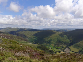
is a popular mountain in Snowdonia, south of the town of Dolgellau. Properly called Cadair Idris (often anglicised to 'Cader'), it rises 892 metres above sea level and, alongside Yr Wyddfa and Pen Y Fan, is one of the most clambered peaks in Wales.

But I've already done the other two, so on this occasion my Eldest and I will attempt to add this behemoth to our list of conquered summits.

We have opted to take the Minffordd path, which begins close to a car park and visitor centre/cafe just off the A487. The rest of our party have opted to remain at the base, so only two of us - armed with water bottles and enthusiasm - set off on the steep ascent, steps climbing up into a gorgeous waterfall valley. Eldest, as usual, has a keen eye for the flora and fauna surrounding us on this arboreal section of the journey.

Butterwort, a carniverous plant

Common Lizard, not camera shy.

Above the tree line, the vista opens before us. The journey will be a relentless uphill slog of about three miles. It will shorten our breath and abuse our feet, and every step we take will immerse us in the mountain and its legends.

Tongues of fire on Idris flaring,
News of foe-men near declaring,
To heroic deeds of daring,
Call you Harlech men.
                                   - 'Men Of Harlech'

Idris is a giant in Welsh mythology, but he seems to have been based on a real historical figure - Idris ap Gwyddno, a king of Meirionydd active in the late sixth and early seventh centuries. The summit of the mountain, Penygadair, the neighbouring 'saddle' and the adjacent peak of Tyrau Mawr are said to form his chair, hence the mountain's name. Boulders at the foot of the mountain are said to be stones shaken out of the giant's shoe, and any who spend the night on the peak will wake as either a poet or a madman.

It is also the hunting ground of Gwyn Ap Nudd, Lord of Annwn (the Celtic Underworld). The howling of his dogs, the Cwn Annwn, are said to foretell death to those who hear it.

Penygadair, the peak of Cadair Idris

To reach the peak we have to clamber up to the peak named Cwm Cau and walk round the ridge. At times the path is clearly defined; at other times, we find ourselves scrambling across rough scree and soft, boggy patches. After reaching Cwm Cau - which is an endurance test in itself - we descend into Bwlch Cau and look upward to the peak, only to find it no longer visible. The rippling ridges, a sea of scree, obscure the view. We have to keep clambering, hands and feet receiving a rough workout, and just keep heading upward. The views, in every direction, are breathtaking.


Below us lies the icy blue water of Llyn Cau. The crater in which it lays has given rise to the mistaken belief that Cadair Idris is an extinct volcano, whereas it is in fact glacial, carved by a cirque glacier during the most recent ice age.

Llyn Cau

Along our journey, we pass various geological features, rich veins of quartz creeping across igneous boulders.

Quartz veins

The descent from Cwm Cau into the saddle provides a brief respite, but before long we once again find ourselves ascending, feeling the challenge, scrambling across loose scree and round immoveable outcrops until, finally, the cairn on the summit is in sight and we can stagger gratefully to its base, glad to have knocked another mountain off our 'To Climb' list, which currently consists of Helvellyn and Ben Nevis.
The summit, 896m/2930ft, 'Penygadair'

Now the descent. We amble along the ridge until... it just kind of stops. Below us, a set of uneven steps disappear into the valley.

The steep valley.


Treacherous, slippery steps which vanish when they reach rock provide our route down from the ridge. Over a mile of them. We are actually quite grateful when we reach the treeline in one piece and descend into our waterfall valley.

Our companions, left behind at the Visitor Centre, inform us that we have been gone for four hours, which tells us that Cadair Idris took us an hour and a half longer to climb up and down than Pen Y Fan two years ago.

We drove away, heading towards our campsite in Shropshire, managing to miss a local monument which, at the time, we knew nothing about - the ruins of Mary Jones' Cottage. In the year 1800, the sixteen-year-old Mary walked barefoot from her home at the foot of the mountain to Lake Bala, twenty-eight miles away, to buy a Bible from the Reverend Thomas Charles. This feat inspired Charles to form the British and Foreign Bible Society, with its aim of supplying remote areas with Bibles. A memorial obelisk stands on the ruins of Mary's home, and a 'Mary Jones World' exists at Bala.

As we drive east, out of Snowdonia and into the Cambrians, the Chair Of Idris is gradually obscured by intervening peaks. We have walked in the realms of giants, of underworld hunts, and pious maidens with extreme fortitude, and emerged tired but intact.

Until the next lofty peak calls to us...


all pictures (c) Charlie McManus

Tuesday, 9 June 2015

The Mere

We arrive to a chaffinch serenade,
And park in the dust with entry paid.
The purple heath smoulders in the sun,
Where vipers slide and rabbits run.
The stonechat snickers, the slow-worm coils,
Beyond the haze, the North Sea roils.
The trees alive with fledgling tits,
Antlions strike from sandy pits.
Below the ridge, the Mere yawns wide,
Ringed by reeds where otters hide.
The bittern booms, the hobby swoops,
Black-head gulls form airy loops.
Harriers glide past squabbling geese,
Avocets nest in watchful peace,
Shovelers bob and terns dip low,
And red deer laze in the Summer glow.
Turtle dove calls from a lofty arbour,
Follow the shore to a sunken harbour.
Pipistrelles spiral in cerulean cool,
Swallows gather where the waters pool.
Charlie and Jin stroll with countenance glad,
Where celebrities gather for their Springtime fad.
Sticklebacks fan over hidden fry,
Under the camera's unblinking eye.
The ruined Abbey squats to our East,
A crumbling relic, a hulking beast.
We welcome Minsmere, forsake all strife,
To bask in joyful streams of life!


Friday, 27 March 2015

The Return Of The King

'Time has its revolutions; there must be a period and an end to all temporal things, finis rerum, an end of names and dignities and whatsoever is of this earth. Where is Bohun? Where is Mowbray? Where is Mortimer? Nay, which is more and most of all, where is Plantagenet? They are entombed in the urns and sepulchres of mortality.'
  - Sir Randolph Crewe

On 22nd August 1485, over 300 years of Plantagenet rule came to an end on a battlefield near Market Bosworth, Leicestershire, when a soldier in the army of Henry Tudor swung a halberd which fatally connected with the head of King Richard III of England, last of the Yorkist monarchs.

Bosworth, by James de Loutherbourg


Post-mortem,  Richard's body was subjected to certain indignities. He was stripped of his armour and thrown naked across the saddle of a horse, then accompanied by Tudor and his victorious retainers to the city of Leicester. After being exposed to public view for a couple of days - to demonstrate to the populace that he was definitely dead - the body of the last Plantagenet monarch was buried, without a coffin, in a hastily dug grave in the city's Greyfriars monastery. Richard's journey to Leicester lacked the pomp, pageantry and even the basic dignity that would normally be afforded a King of England on his way to his grave.

530 years later, Leicester took the opportunity to make it up to him.

Tricky Dicky.


I've wanted to visit Leicester for a long time, ever since I went through my 'Roman' period in the late 90's. I wanted to visit RATAE, the capital of the Corieltauvi tribe, wanted to see the baths complex known as the Jewry Wall.

Last Sunday I finally got to visit the Jewry Wall, but in a completely different context from that which I had originally envisaged. I came to Leicester on a bright and warm Sunday with my sons, not to specifically visit a Roman ruin, but to say goodbye to a King.

The Jewry Wall is bustling with visitors. The adjacent road and church mark the spot where the King will enter the City centre, and the old ruins are making the most of the carnival atmosphere. Morris men prance in the consolidated rubble. The great Roman remnant stands aloof, gazing down on the proceedings with haughty disdain.

St Nicholas Church and the Jewry Wall. With Morris dancers. According to legend, King Lear was buried under this spot, in a temple dedicated to Janus.


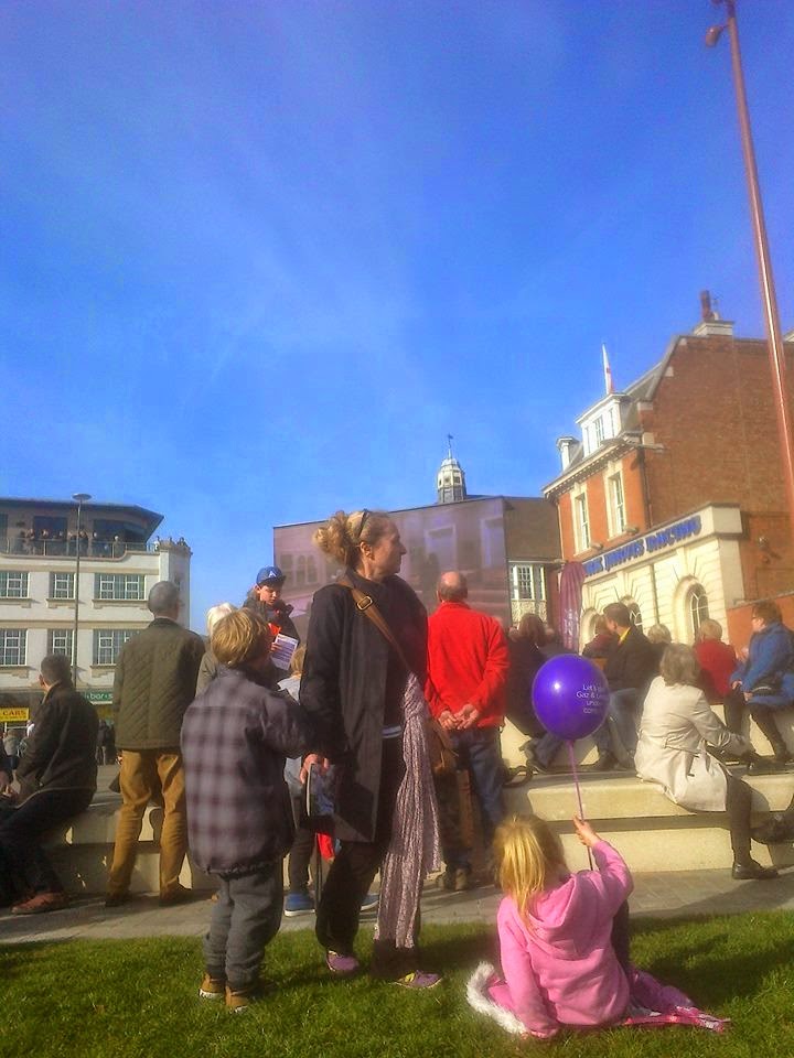
Leicester is buzzing today. 25,000 people have descended upon the City yet, strangely, it doesn't feel crowded. The roads are not at a standstill. Parking was a doddle. We left the car on the second level of a multi-storey behind John Lewis and strolled into the City Centre, instantly soaking up the carnival atmosphere of expectation. Everyone is smiling. Some are clad in medieval costume. Others clutch white roses, the symbol of the House of York.

Inside the ring-road from the Jewry Wall stands St Nicholas Square, one of Leicester's open spaces, and a large screen has been erected here, broadcasting the events as they unfold. The procession started hours ago, out in the Leicestershire countryside, and is winding its gradual way toward the City. In a couple of hours it will cross the Bow Bridge over the River Soar, and Richard Plantagenet will enter the City for the last time.

St Nicholas Square, and an air of expectation...


The story unfolding across the screen reminds us of the discovery, two and a half years ago, of a skeleton in a car park. They went looking for Richard, but few expected to actually find him. Richard Buckley, of the University's Archaeology Department, said he would 'eat my hat' if the King were actually found. He later ate a hat-shaped cake baked by a colleague. I remember seeing the bulletin on the evening news, the uncovering of a skelly on the Greyfriars site, a skelly with a crooked spine, and I remember staring gobsmacked at the TV and saying, 'F**k me! They've actually found him!"

Of course, it took several months of scientific analysis and DNA testing at the University of Leicester before they could call a press conference and confirm the skeleton's identity, but let's be honest - from the moment it was uncovered, it was never going to be anyone else.

We pick up a leaflet from a stall in the Square, and head off to explore the medieval street pattern of Leicester. We pass the Cathedral, TV crews already setting up in the grounds. We pace along New Street, stopping to glance briefly at the country's most famous car park, now off-limits. We explore the Lanes, a maze of winding streets and small, intimate shops. Youngest son splashes £8 on a crystal to wear around his neck. We call in on ASK, and treat ourselves to an Italian lunch.

Time is marching on, and we convey ourselves back across St Nicholas Square, taking up position on the roadside opposite the Jewry Wall. The crowds are dense, and the air is heavy with happy expectation. A stall to our rear sells tea and coffee in styrofoam cups. A dull, distant throbbing fills our ears as media helicopters buzz the sky above.

The horses arrive first, taking up position next to the church where the King will stop for a blessing. He will arrive in a hearse, but after the blessing he will be placed on a carriage and drawn through the streets of Leicester by four horses. The horses have been drafted in from the City Of London police, and are trained at dealing with events such as the Trooping Of The Colour. They are Lionheart, Ariel, Temple and Bowron.

Lionheart, Ariel, Temple and Bowron. (c)Charlie McManus


The air is heavy with anticipation, yet the crowds fall silent as the hearse appears. Only the rhythmic hum of the helicopters punctuates the quiet. The clergy of St Nicholas have lined up on the pavement to greet the monarch, and Richard's simple coffin is unloaded onto the shoulders of pallbearers and respectfully carried into the church.

While the brief ceremony is taking place, we make our move. Alongside many others, we decamp from our pitch and head into the city centre. Barriers line the High Street; we take up our second position near the Clock Tower in the heart of Leicester, my youngest son and I clambering onto a bench for an elevated view while my eldest son snakes his way to the barrier, camera at the ready.

Twenty minutes later, now decked out with the accoutrements of medieval pageantry, the King passes us again


(c)Charlie McManus


It was at this junction that one of the helicopters took the aerial photograph that would grace half of the next morning's newspapers, but I'm damned if I can make out my sons or myself in that crowd. Besides, we were probably on the move again at that point; while the cortege takes the long way round, we and many others hurry our way through the winding streets, past the stalls of Leicester Market, finding our way to the last street along the funeral route - a single lane road leading to the Cathedral. The crowds are thinner here and there are no barriers. Soon enough, the cortege comes swinging round the corner. People step into the road to cast white roses at the passing coffin; I fumble for my phone, switch to camera mode and click off a quick shot as the mortal remains of Richard Plantagenet pass by virtually under my nose.


We watch solemnly as the cortege disappears around the corner, heading for the Cathedral yard where it will be greeted by the Bishop Of Leicester and HRH Richard Duke of Gloucester, cousin of the Queen, who holds the same name and title that the late King held before he was enthroned.

My sons and I are buzzing. This will probably be the only chance in our lifetimes to give a medieval King a send-off, and we have risen to the challenge. As we make our way through the streets of Leicester, we feel a quiet sense of satisfaction that we have paid our respects to our most controversial monarch, and done our bit to give him the regal farewell denied him 530 years ago.

Richard's journey is over. The King In The Car Park can, finally, rest in peace.

'Shine out, fair sun, 'til I have bought a glass
That I may see my shadow as I pass!'
                                                         Shakespeare, Richard III